
The Moat
The Moat lies behind houses on Balderton Lane, almost opposite The Homestead. You can see parts of the Moat from the pavement near “Moat Edge”. (The Moat is on private property and may only be viewed from the road.)
The link below will take you to an aerial photograph / OS map overlay (hover over the photo) on the multimap website. The moat can be seen as an outline of black water to the West of Balderton Lane: Aerial photo of the Moat in Coddington (close new window to return here).
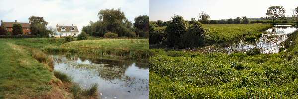
The moat is a listed ancient monument, probably 12th century. Fed by a stream, it would have been about 2m deep. We have no surface evidence for any buildings on the island which was connected to the mainland by a causeway, now gravelled over. The Moat connects up with the fishpond, which is surrounded by trees and lies north of the old A17 opposite the School. These photographs taken looking roughly East and West show the Moat behind the house called Moat Edge:
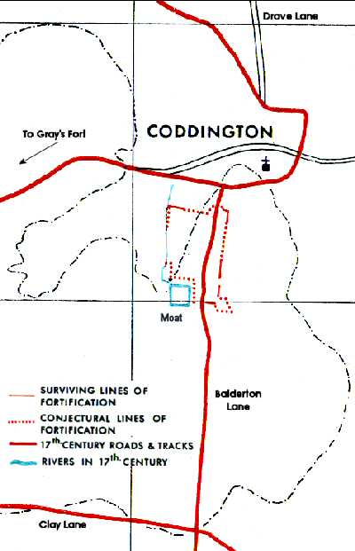 During the Civil War when Parliamentary siege earthworks were built in Coddington the Moat was left outside of the defences, since the wet ditch would have hampered communication with or along the enceinte (encircling fortification). North of the moat, the stream that fed it was used as part of the west side of the defences.